Transoft Solutions

The story behind Plex.Earth: Taking the guesswork out of civil design

The story behind Plex.Earth: Taking the guesswork out of civil design

You have just won your next project and can't wait to create a model for your design. You have been in that position, right? Then, you know it: the whole process can be a cumbersome, time-consuming and prone to errors experience.

In 2009, Lambros Kaliakatsos, Plexscape founder & CEO, being a CAD manager back then, got a bitter taste of the difficulties designing without having the complete real-world view of his sites, anytime he needed it.

Having experienced the high cost of rework on projects he was responsible for, he decided to do something about it.

So, in case you wonder, here’s our story, as published in the TwinGEO magazine by the popular blog Geofumadas!

Free webinar: 3D vehicle simulations in Google Earth with Plex.Earth and AutoTURN Pro

Looking to publish your 3D vehicle simulations in Google Earth?

We’re hosting a free webinar with our trusted partners, Transoft Solutions, to show you how you can do this easily and quickly, with Plex.Earth and AutoTURN Pro.

Join this webinar to learn how to import the most up-to-date satellite imagery, create swept path analyses and display the end result in Google Earth.

The benefits are numerous:

► You can share breathtaking presentations with anyone you want.
► Take instant feedback whenever you need it to meet your project deadlines.
► Impress your clients and land new ones.

Plex.Earth and AutoTURN Pro live webinar
Date: Thursday, June 13, 2019
Time: 10:00 AM PT | 12:00 PM CT | 18:00 PM CET
Hosts: Nicolas Paraskevopoulos, Customer Support Specialist at Plexscape
Majo Varghese, Sales Consultant at Transoft Solutions


Plex.Earth and AutoTURN PRO free webinar: How to create the most realistic 3D vehicle simulations in Google Earth

Plexscape has partnered with Transoft Solutions allowing engineers and designers to create and share impressive presentations of their swept path analysis into Google Earth.

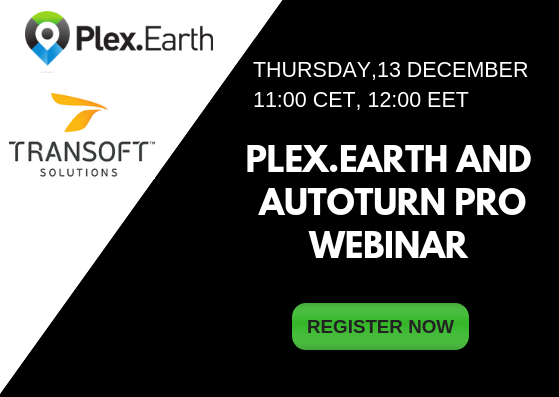
Following the integration of their popular software, Plex.Earth and AutoTURN PRO alike, the two companies announce their first free webinar which will take place on Thursday 13th of December at 11:00 AM CET (12:00 GMT+2 or EET).

Those who are interested can register here.

This in-depth training run by in-house specialists of both software will show engineers and designers how to import high-quality satellite imagery, create swept path analysis and display the end result in the Google Earth environment.

The attendants will have the opportunity to experience first-hand the value of bringing together Plex.Earth with AutoTURN technology, as shown in this video.

According to “Make it, or break it - Global Construction Survey 2017” by KPMG, companies still struggle to deliver projects on time and within budget.

However, by publishing their 3D vehicle content in Google Earth, engineers now have a powerful tool in their hands: they can create and share breathtaking presentations with their customers or colleagues and take instant feedback, whenever they need it. Therefore, they can reduce revisions and meet their project’s deadlines and budget goals.

All registrants will receive a full recording of the presentation, so they can sign up even if they’re not sure they can attend.

Plex.Earth and AutoTURN PRO webinar
DATE: Thursday, December 13, 2018
TIME: 11:00 CET (12:00 GMT+2 or EET).
HOSTS: David Homola, Product Manager at Transoft Solutions EMEA,
Nicolas Paraskevopoulos, Customer Support Specialist-Civil Engineer at Plexscape

About Plexscape

Plexscape is a software company committed to changing the way engineers work on Architectural, Engineering, and Construction (AEC) projects, by developing innovative solutions that bridge the gap between design and the real world.

Plex.Earth, our flagship product, is the first cloud-based software ever created in the CAD market and one of the most popular tools in the Autodesk App Store.

Our solution, originally released in 2009, is being used by more than 15,000 engineers in over 120 countries worldwide, enabling them to have the complete 3D geographical view of their real-world project sites within minutes, through Google Earth and other satellite data providers. For more information on Plex.Earth's benefits, visit www.plexearth.com.

About Transoft Solutions

Transoft Solutions develops innovative and highly specialized software for aviation, civil infrastructure, and transportation professionals. Since 1991, Transoft has remained focused on safety-oriented solutions that enable transportation professionals to design with the utmost confidence. Our portfolio of planning, simulation, modeling, and design solutions, are used in over 130 countries serving more than 50,000 customers across local and federal agencies, consulting firms, airport authorities, and ports. We take pride in providing best-in-class customer support from our headquarters in Canada, and through offices in Sweden, the United Kingdom, Netherlands, Australia, Germany, India, Belgium, and China.

For more information on Transoft’s range of trusted and field-tested engineering software, visit www.transoftsolutions.com/emea.


Transoft Solutions and Plexscape partnership offers the most realistic 3D vehicle representation on Google Earth

Transoft Solutions Inc., a global leader in transportation engineering design and analysis software, has partnered with Plexscape, developers of Plex.Earth®, one of the most popular tools for AutoCAD for the acceleration of architectural, engineering and construction (AEC) projects. Central to the partnership was integrating AutoTURN® technology with Plex.Earth to allow engineers and designers to demonstrate vehicle swept path analyses directly into Google Earth enabling them to create and share engaging presentations and reduce revisions and overall cost.

“Civil engineering is about making the world a better place and here at Plexscape we are committed to help engineers by always giving them the most accurate real-world view of their project sites”, said Mr. Lambros Kaliakatsos, Founder & CEO of Plexscape. “For 9 years now, Plex.Earth, our flagship solution, enables them to have instant access to high-quality satellite imagery and terrain morphology data. We strongly believe that our partnership with Transoft Solutions, a company that has changed the way the future of transportation is being designed, will help AEC professionals make design decisions with more confidence and keep their projects on time and on budget".

This statement is fully aligned with Transoft’s mission to provide solutions that allow its customers to design with the utmost confidence.

“Plex Earth is a perfect addition to AutoTURN Pro. In our partnership with Plex.Earth we made sure that our massive 3D vehicle content is displayed well in Google Earth” says Alexander Brozek, Vice President & General Manager of Transoft Solutions EMEA. Engineers can easily demonstrate their performed swept path analysis for impressive and self-explaining presentations or running quick checks in the conceptional phase of a project. It was our pleasure to work with Plexscape on a project which makes the real capabilities of AutoTURN Pro to stand out."

About Transoft Solutions, Inc.

Transoft Solutions develops innovative and highly specialized software for aviation, civil infrastructure, and transportation professionals. Since 1991, Transoft has remained focused on safety-oriented solutions that enable transportation professionals to design with the utmost confidence. Our portfolio of planning, simulation, modeling, and design solutions, are used in over 130 countries serving more than 50,000 customers across local and federal agencies, consulting firms, airport authorities, and ports. We take pride in providing best-in-class customer support from our headquarters in Canada, and through offices in Sweden, the United Kingdom, Netherlands, Australia, Germany, India, Belgium, and China.

For more information on Transoft’s range of trusted and field-tested engineering software, visit www.transoftsolutions.com/emea.

About Plexscape MON. E.P.E.

Plexscape is a software company committed to changing the way engineers work on Architectural, Engineering and Construction (AEC) projects, by developing innovative solutions that bridge the gap between design and the real-world.

Plex.Earth, our flagship product, is the first cloud-based software ever created in the CAD market and one of the most popular tools in the Autodesk App Store.

Our solution, originally released in 2009, is being used by more than 15,000 engineers in over 120 countries worldwide, enabling them to have the complete 3D geographical view of their real-world project sites within minutes, through Google Earth and other satellite data providers.

For more information on Plex.Earth's benefits, visit https://plexearth.com/

Plexscape joins forces with Transoft Solutions

Since the creation of Plex.Earth in 2009, we have been committed to changing the way engineers work on Architectural, Engineering and Construction (AEC) projects, by bridging the gap between design and the real-world.

Following through on our commitment, we are excited to announce our partnership with Transoft Solutions, a global leader in transportation engineering design and analysis software.

Central to the partnership is integrating AutoTurn with Plex.Earth, allowing engineers and designers to demonstrate vehicle swept path analyses directly into Google Earth.

By creating and sharing self-explaining presentations in the Google Earth environment, engineers can make design decisions with more confidence, reduce revisions and keep their projects on time and on budget.

Do you want to know what Plex.Earth can do for you? Start your free trial now and stay tuned for more!