Plex-Earth: Talking about Telecoms
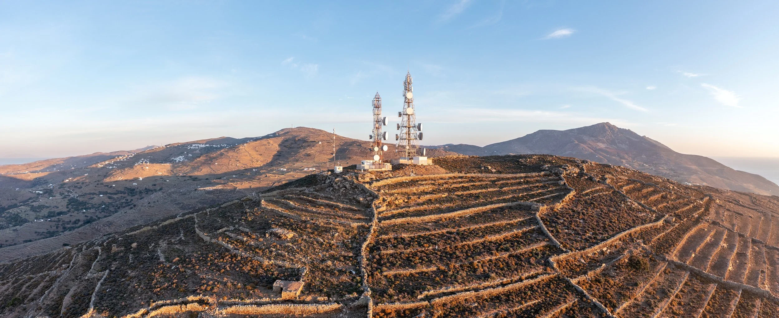
The telecoms industry has a lot of highs and lows – such as the high challenge of positioning transmission towers on higher ground, and in contrast it really doesn’t get much lower than routing cables below ground!
Resolving both of those challenges requires precise and accurate information about the terrain, so let’s explore how Plex-Earth let’s designers design with confidence.
Plex-Earth provides a comprehensive suite of tools that that effectively make it a GIS, but built specifically for engineers.
By integrating directly into AutoCAD, the plugin offers a seamless and intuitive user experience, giving engineers access to the 3D terrain data and satellite or aerial imagery they need to make informed decisions.
Let’s look at terrain first.
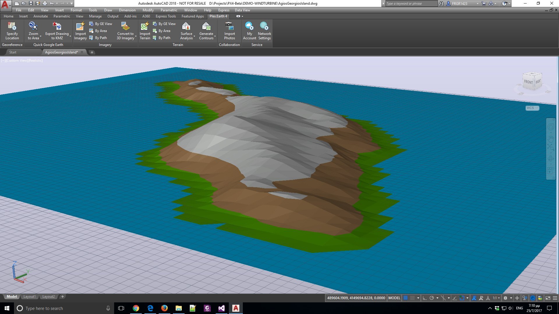
Elevation Mapping (Hill Shading) instantly identifies peaks, making it obvious where communication towers should go.
One of the standout features of this plugin is its advanced terrain analysis capabilities.
This includes calculating soil volumes, which can be incredibly helpful in finding the best cable routes while avoiding excessive earthworks, or even in determining the feasibility of a project.
By providing visual, 3D terrain data (mesh or contours), easy importing of GeoTIFF images and DEMs (Digital Elevation Models), the plugin enables engineers to have a thorough understanding of the landscape. This not only improves the efficiency of the design process but also helps to reduce the risk of hazards, the costs of re-work, and avoids design redundancies.
Imagery
Accurate terrain data is critical, but as the saying goes, “A picture is worth a thousand… data points!”
Plex-Earth is equally famous for bringing updated satellite and aerial imagery into AutoCAD, as a correctly aligned background, and from a variety of providers. For some situations, the colorful, almost cartoon-like imagery of Google Maps is best for easy communication, while double-checking with our more-frequently updated providers allows designing with confidence.
We also make it easy to stitch together images to cover long or wide areas, as a ‘mosaic’, without the Earth-curvature alignment issues you’d face doing so manually!
Overview of Essential Features
· Display Your Project Areas in AutoCAD, with Updated, Hi-Res Aerial Photography
· Multiple Imagery and Terrain Providers, including. Maxar, Airbus, Nearmap, and Hexagon
· Easy Quotation, Booking, and Importing of Drone Photos and Data from Inflights
· Long or Wide Projects with our Seamless Auto-Alignment of Multiple Images
· Design with Confidence, with Visual, 3D Terrain Data (mesh or contours)
· Help Communicate Your Designs to Non-Technical Stakeholders
· Easy Calculation of Soil Volumes Avoids Excessive Earthworks
· Avoid Hazards, Re-Work or Design Redundancies
· Monitor During and After Your Projects
Plex-Earth’s variety of imagery also facilitates communication with non-technical stakeholders, making it easier to present designs and share information. This can be particularly valuable in gaining project approvals and ensuring that everyone involved in a project has a clear understanding of the objectives and challenges.
Seamless Integration with AutoCAD: More than ‘Nice to Have’
Switching between AutoCAD and a GIS doesn’t just break the user’s concentration; it can lead to costly mistakes, so Plex-Earth's seamless integration with AutoCAD is a major advantage!
By consolidating all the necessary data and imagery within AutoCAD, your engineers can streamline their workflows, completely avoiding the need to switch between programs.
Conclusion
The AutoCAD plugin for telecoms engineers offers a powerful solution for tower positioning, cable routing, and everything in between, addressing the unique challenges faced in the telecom industry.