Plex-Earth 2023: Our Biggest Blockbuster Ever!
Plex-Earth 2023 – it’s our biggest release… EVER!
First up is the debut of our newest rising star…
Introducing Inflights drone data – book custom flights!
Yes! For the first time ever, Plex-Earth brings you discounts on custom DRONE flights, with our little flying friends available almost anywhere on Earth!
Generating 2D orthomosaics, 3D models and maps can often have a higher degree of precision than traditional surveying methods. This game-changing development transforms Plex-Earth into a mandatory tool, not only for your early design stages, but for all design and even the later construction stages!
You just select the target area and pick your options from within Plex-Earth. You’ll soon receive a fast and firm quotation from a local independent pilot – and your Plex-Earth discount!
Your order activates the Inflights platform, which can obtain, process and analyze imagery and data from a global network of independent drone pilots and their equipment. This brings you consistent results with expert processing and analysis, while smartly avoiding the usual hassles of trying to arrange your own equipment or permits
It’s (nearly) all the fun of flying your own drone, without the flip-sides!
Orthomosaic expertise - multiple high-res’ drone images stitched together for you!
See our joint press release here: Drone data in AutoCAD: Plex-Earth and Inflights
Co-starring Cesium, a rising star in global 3D terrain!
Analytical Graphics Inc. went on a mission to produce the most accurate digital 3D version of our planet – all of it – ever created. The results are impressive!
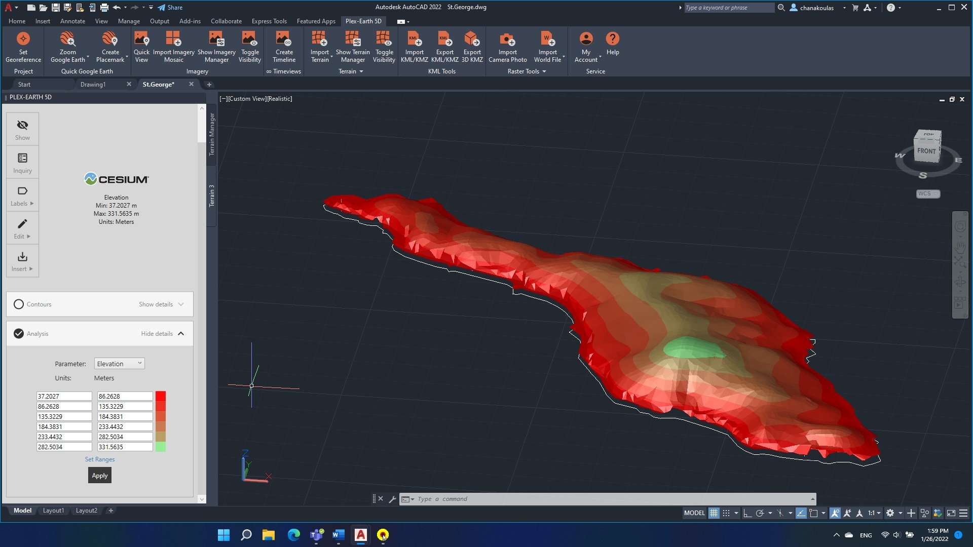
Plex-Earth still offers terrain data from Amazon and Google Earth, but also introduces Cesium. Now you can choose from the unique characteristics of each provider, picking the best option for the different stages of your project, including the risks to avoid or the people you need to impress!
Importing 3D terrain into AutoCAD is now much improved, with:
Google Earth, Terrain Tiles (AWS) and now Cesium!
Fewer clicks
More features
Faster processing - much faster!
Global coverage of 3D terrain
Mesh points or contours, you’ve got it all!
Effortlessly imported onto your AutoCAD .dwg
Terrain analysis made easy (see tutorial link below)
Resolution varies by location, from 30 meters down to 50 cm!
Rising star Cesium is already winning the hearts of engineers!
See more here: Importing terrain into AutoCAD tutorial
Time-Travel Special Effects by TimeViews™!
It wouldn’t be a blockbuster without a superpower or some special effects, and in Plex-Earth 2023 the hero – that’s YOU – can travel back in time!
A timeline of historical satellite imagery inside AutoCAD let’s you see what’s stayed the same, changed or is still changing, with:
Worldwide coverage!
Various datasets available
High-quality and high-resolution from Airbus and Maxar
Spanning as long as 10 years or as recent as a few days ago!
This is the Arena MRV in Brazil, during construction.
Note that because this is real imagery, for best results you can select periods without cloud cover!
See more about Plex-Earth Timeviews
Talking about timeliness and being up-to-date…
Putting premium satellite and aerial imagery in AutoCAD: Maxar, Airbus, Hexagon and Nearmap!
Satellite imagery doesn’t have to be Bing!
With global coverage, imagery that can be just a few days old and resolutions down to 30cm, Maxar or Airbus can take your satellite image background to the next level!
It’s not hard to tell which image is most up to date…
With Plex-Earth 2023:
Static raster image – no flickering or reloading every time you zoom
Static images also avoid over-consumption of premium imagery
Multiple-image mosaics, to cover large areas at high resolution
Most areas only weeks old, not months or years!
Resolutions down to 50 or even 40 cm satellite
Resolutions down to 30, 15 or even 7.5 cm aerial
You can see the bigger picture with satellites, while our aerial imagery from Nearmap and Hexagon can reveal the finer details across the US, Australia, Canada and the urban areas of New Zealand.
How fine? Depending on the supplier and area it can be 30cm, 15cm, even 7.5cm resolution!
Special Guest Appearance: Google Maps and Google Earth
Yes, the crowd-pleasing Google Twins return to your big AutoCAD screen!
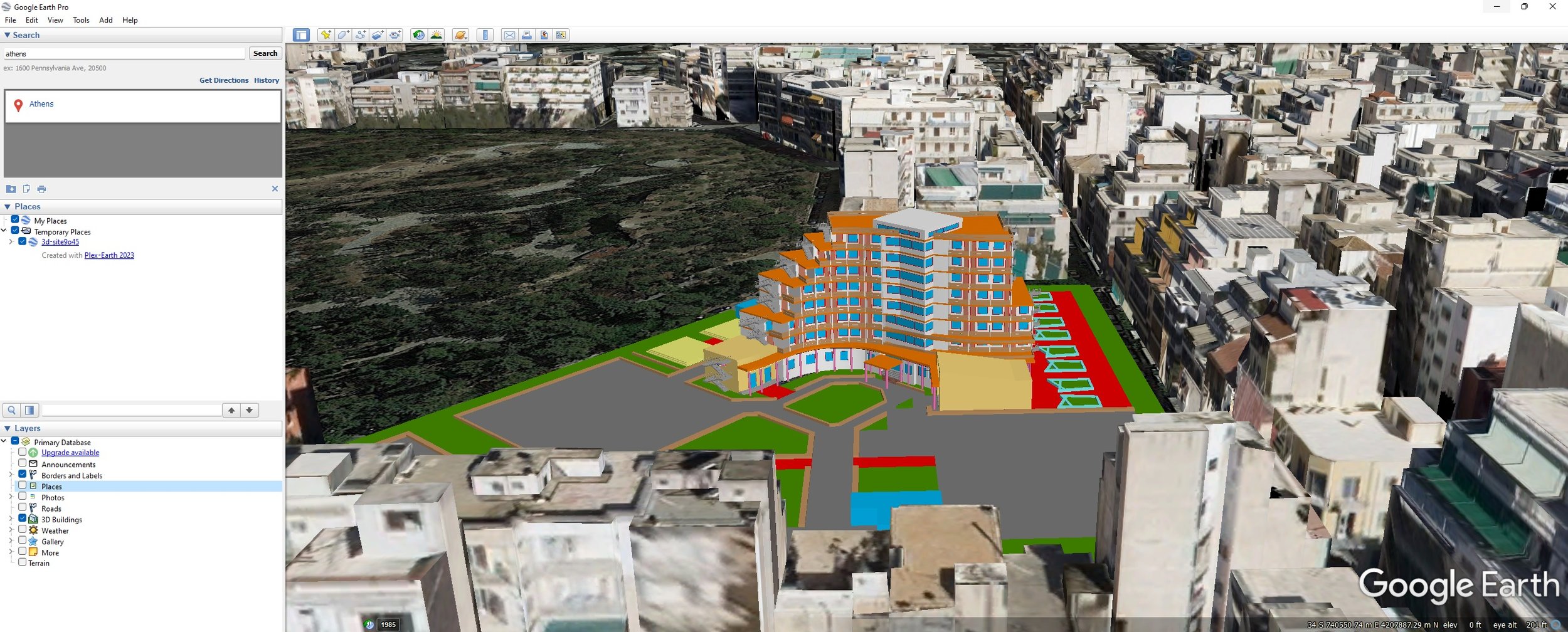
Google Earth + AutoCAD = easy with Plex-Earth 2023!
Exporting objects into Google Earth is another crowd-pleaser that returns to grace the big screen!
Exporting from AutoCAD into Google Earth is easy with Plex-Earth!
Updating from Plex-Earth 4.0?
Plex-Earth 2023 offers you everything you love about 4.0, including the return of the Google Earth goodness, while offering you even more flexibility and power!
As a current Plex-Earth 4.0 user you’re entitled to extra-special assistance when stepping up to this new platform, including booking a free Teamviewer session where we’ll walk you through the differences. We even have a special PE4 to PE2023 transition tutorial just for you!
Functional free trial? Of course!
Most movies only last around 90 minutes; our free trial lasts 7 whole days and yes you can use Plex-Earth 2023 on a real project, right now!
Compatibility with AutoCAD 2023
Game changing companies look forward and being one step ahead is always a plus. Plex-Earth 2023 offers full compatibility with the just released AutoCAD 2023, as well as with its most popular verticals (Civil 3D, Map 3D, Architecture, Mechanical, Steel).


