How to create imagery and terrain corridors with Plex.Earth 4 (roadwork/railroad projects)
Looking to import imagery/terrain along a corridor into AutoCAD for your roadwork or railroad project?
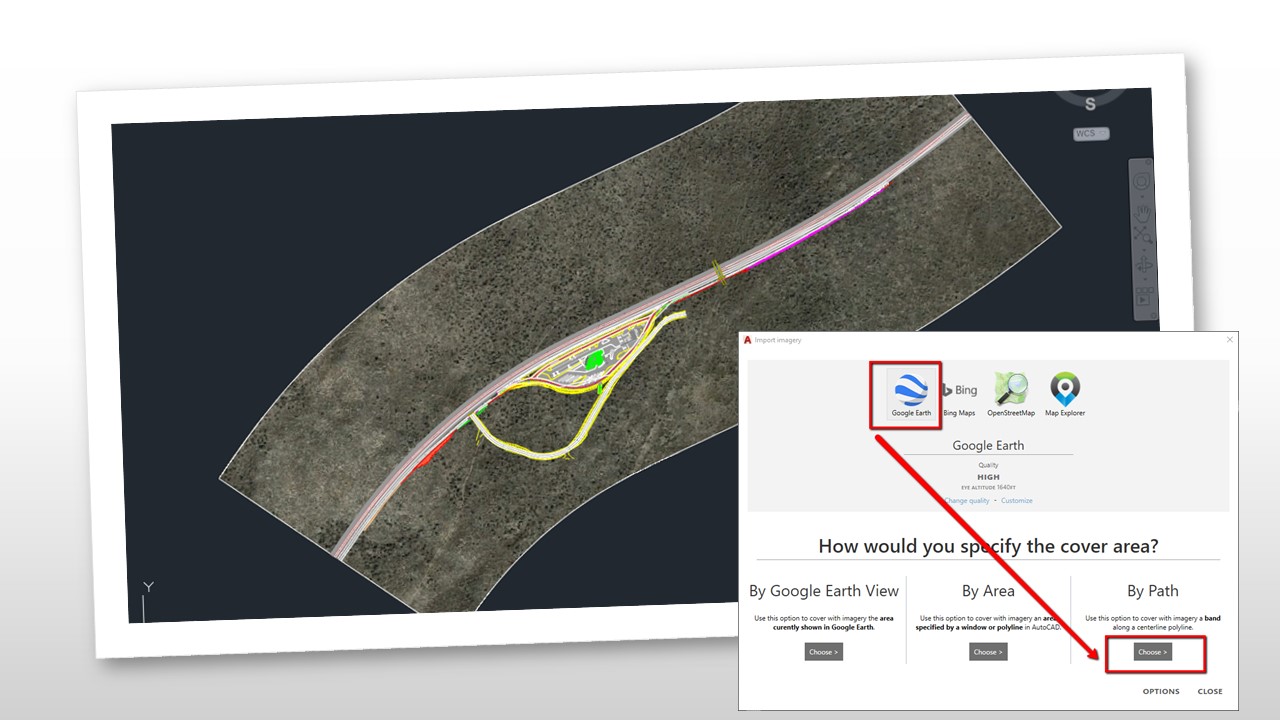
We have prepared a tutorial to show you how to do this, with Plex.Earth 4, easily and quickly: By choosing to import imagery using the “By Path” option, you can decrease the import time significantly and boost your productivity.
Check it out and watch this space for more tutorials and helping materials!