Bagging the big ones in Africa, while safe and comfortable in your home office?
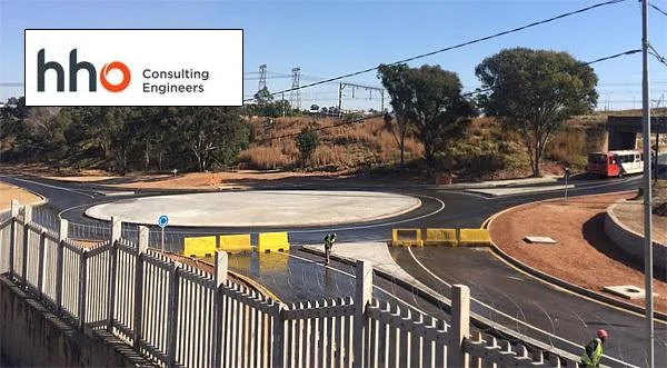
How fast and accurately could you draw a preliminary design for a 60 kilometer road project (and a bridge) in Zambia, Central Africa?
That was the real-world challenge faced by Graham Demmer, of HHO Consulting Engineers, nearly 2,000 km away in South Africa’s Cape Town.
Mention Zambia to most people and they think of safaris, the Big 5 big game animals, or perhaps the majestic power of Victoria Falls. To an engineer like Graham that land-locked nation, 1,200 meters above sea level, means the string of copper mines known as The Copper Belt, remote locations and a challenge, because his company had never worked for a Zambian company before!
That preliminary drawing however, was not going to be a problem for Graham.
“I remained in Cape Town and using Plex.Earth was able to extract and geographically position aerial imagery and contours along the entire 60km route. Doing this gave our design team an excellent head start in achieving a conceptual/preliminary design before the appointed surveyor was eventually able to complete the required survey.”
Long-project corridor lines - and short deadlines - made easy!
The secret to Graham’s confidence was the easy “tiling” and “corridor” abilities of Plex.Earth, which makes long corridor-style projects as simple as dragging your mouse, and then telling the AutoCAD plugin how wide you want your corridor to be.
Yes, it really is that easy!
All the usual problems such as choosing which images from Google Earth™ you need, and then perfectly aligning them for you, are solved by the software.
And yes, all the parts and all the lines of all those images will line up, because Plex.Earth automatically corrects the flattening effect of 2D photos of our 3D world!
Said Graham:
The accuracy of the contours generated by Plex.Earth was impressive and only required us doing a global change of roughly 1m to all the preliminary generated levels.
This helped a very pressurised team achieve a deadline for a Client in a part of Africa we had never worked for before.
And made for the long haul too
HHO Consulting Engineers, which has branches in Cape Town, Johannesburg, and East London, have been enjoying the power of Plex.Earth since version 2.0 in 2011.
“The Plex.Earth software is powerful, fast and easy to use and has helped us over the years with concept and preliminary design, visualisation, positioning projects correctly, converting incorrectly co-ordinated data to the correct project specific co-ordinate systems, creating surfaces and creating drawings with geotagged photos.
I commend the Plex.Earth team as I have watched their software develop and continually improve to achieve the latest Plex.Earth 4.”
You can start your own journey with fast and easy joining of AutoCAD with Google Earth, Bing maps or any aerial and satellite image provider, by downloading our free trial. No credit card is required to download and try today.
About HHO
HHO is a South African-based privately-owned civil engineering consultancy, opened in Johannesburg more than 90 years ago. The company strives hard to improve the lives of others via the design and facilitation of high quality infrastructure, a deep commitment to skills development, procurement from empowered suppliers and corporate social investment. All 3 HHO branches have maintained ISO 9001 certification since 2005.