Have a perfect view of your projects
You are always looking at the bigger picture to make the best design decisions, and satellite or aerial imagery is uniquely suited to give you both invaluable understanding and advantages. It’s actually better than being there!
Use the image provider bringing you the best quality
As Plex-Earth brings you multiple image providers you can pick the ideal image for each stage of your project. Choose from the colorful and familiar Google Maps to realistic razor-sharp, updated and fully-licensed images from Airbus, Maxar, Nearmap or Hexagon – or even order a custom drone flight for images and data, resolving down to a single centimeter!
Imports a map with two clicks in 10 seconds
Select the imagery source and specify the area to cover. In a few seconds you’ve already got the satellite or thematic map background into your drawing. That simple!
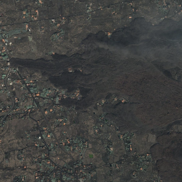
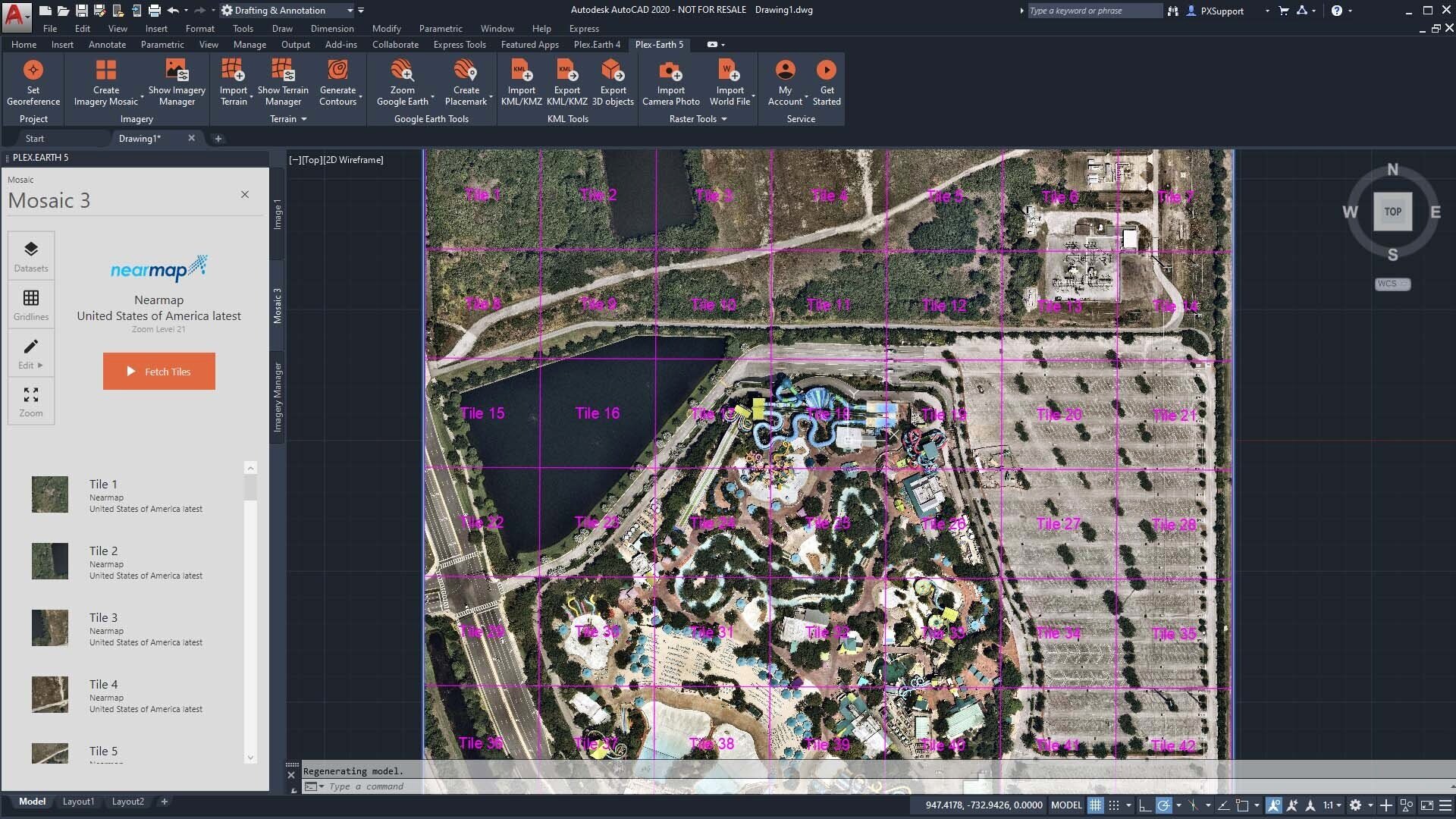
Cover huge areas automatically, in minutes
A common problem in mapping is how the bigger the area an image covers, the lower the quality and accuracy. The old solution was to manually create mosaics by splitting large areas into smaller parts; called ’tiles’. Plex-Earth automates all that for you, by importing hundreds of properly aligned high resolution images, in just a few minutes. Done!
Covering long roads or paths? No problem!
When you work with networks, roads or other corridor-type projects, you need imagery covering a band along the centerline. In Plex-Earth you only have to specify the corridor width – let your full-auto Mosaic Creator do the rest.
image processing built-in
Images are not always totally perfect, so Plex-Earth comes with a full set of processing capabilities. Merge multiple images into one to significantly improve AutoCAD’s performance when it contains too many images. Clipping image borders allows you to remove decorative side-features etc etc. All the capabilities to achieve your desired results are already built right into Plex Earth.
Because seeing is believing!
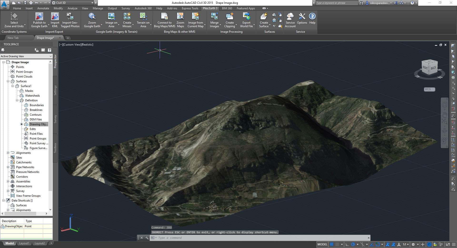
Import ultra-high resolution aerial imagery to cover your entire project area within seconds!

Use on large projects (like roadway design) and have complete control over the imported satellite images. Plex-Earth will also auto-align each image individually for optimal accuracy!